MARK HESS ILLUSTRATION: BARD COLLEGE MAP PROJECT
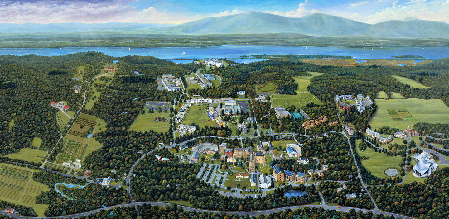
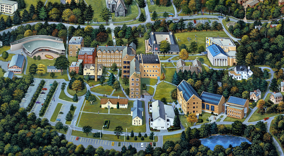
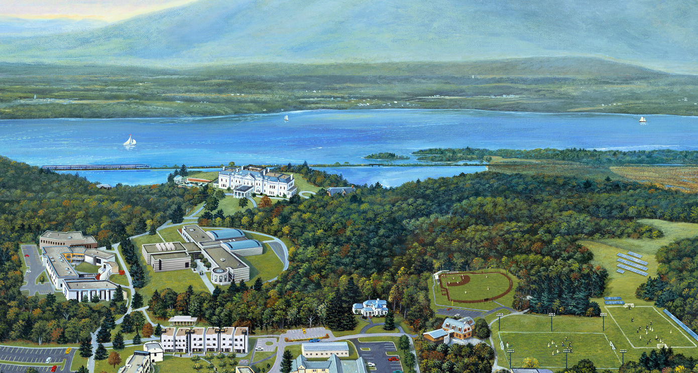
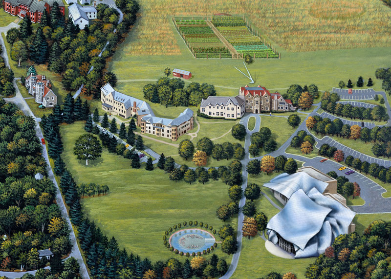
Mark Hess was commissioned in 1999 to illustrate a campus map for then-tiny Bard College, two hours north of NYC on the Hudson. Mark originally shot aerial views from a helicopter to begin his work but now relies on Google earth to update new buildings, roads, play fields and land acquisitions.

Every couple of years Mark is asked to revisit the map to add new features. This involves research; shooting ground level photos; painting and digital manipulation of the existing artwork.

Eighteen years later, Mark’s illustration continues to reveal the cutting-edge expansion of this remarkable institution while maintaining the intimate hand painted quality of his original map.

Coincidentally, his daughter Elyssa applied and was accepted to Bard in 2002, where she received a degree in film making. She is a successful film maker in Brooklyn and Hess couldn't be prouder, "I love working with the people at Bard, and being a small part of the Bard family along with my daughter is way cool."

BLOG ARCHIVE
ISPOTTERS IN THE NEWS
- ► A
-
►
B
- Christina Baeriswyl
- Roman Bailey
- Andrew Baker
- Anna & Elena Balbusso
- Anna & Elena Balbusso
- Polina Barkovska
- Stephen Barnwell
- Jonathan Bartlett
- Rocco Baviera
- Chris Beatrice
- Melinda Beck
- Wesley Bedrosian
- Dan Bejar
- Ben the Illustrator
- Jon Berkeley
- Juan Bernabeu
- Elizabeth Berrien
- Manuela Bertoli
- Anni Betts
- Chi Birmingham
- Phil Bliss
- Mitch Blunt
- Giulio Bonasera
- Davide Bonazzi
- Jens Bonnke
- Richard Borge
- Simona Bortis-Schultz
- Stuart Bradford
- Corey Brickley
- Stuart Briers
- Stuart Briers
- David M. Brinley
- Lou Brooks Collection
- Owen Brozman
- Nigel Buchanan
- Dominic Bugatto
- John Burgoyne
- Oliver Burston
- Michela Buttignol
- blindSalida
-
►
C
- Taylor Callery
- Harry Campbell
- Ivan Canu
- Mariaelena Caputi
- Maria Lucia Carbone
- James Carey
- Mike Carina
- Jonathan Carlson
- Maria Carluccio
- Maddalena Carrai
- Shaniya Carrington
- Cheryl Chalmers
- Doug Chayka
- Navina Chhabria
- Valerie Chiang
- Matt Chinworth
- Camille Chisholm
- Sam Chivers
- Michael Cho
- Andrea Cira
- Andrea Cobb
- Jim Cohen
- Raul Colon
- Matthew Cook
- David Cooper
- Dawn Cooper
- Matthew Cooper
- Stephanie Dalton Cowan
- Stephanie Dalton Cowan
- Bea Crespo
- Mirko Cresta
- Benedetto Cristofani
- Peter Crowther
- Aldo Crusher
- Dave Cutler
-
►
D
- Traci Daberko
- Traci Daberko
- Christina Dallorso
- LJ Davids
- Miguel Davilla
- Gab K De Jesus
- Andrea De Santis
- Solene Debies
- Maravillas Delgado
- Todd Detwiler
- Michael DiMilo
- Sandra Dionisi
- Daniel Diosdado
- Rob Dobi
- Ian Dodds
- Rebekka Dunlap
- Ken Dutton
- Jean-Manuel Duvivier
- John S. Dykes
- John S. Dykes Collection
- Philippe de Kemmeter
- ► E
- ► F
-
►
G
- Susan Gal
- Daniel Garcia
- Paul Garland
- Chris Gash
- Federico Gastaldi
- Heather Gatley
- Michael Gellatly
- Cathy Gendron
- Patrick George
- Beppe Giacobbe
- Beppe Giacobbe
- Carlo Giambarresi
- Carlo Giambarresi
- Michael Glenwood Gibbs
- Paul Giovanopoulos
- Randy Glass
- Charles Glaubitz
- Anna Godeassi
- Anna Godeassi
- Riccardo Gola
- Beth Goody
- Aad Goudappel
- Christian Gralingen
- Addison Green
- Sam Green
- Joey Guidone
- Adam Gustavson
-
►
H
- Chad Hagen
- Eric Hanson
- Sarah Hanson
- Asaf Hanuka
- Antony Hare
- Lisa Henderling
- John Hersey
- Daniel Hertzberg
- Daniel Hertzberg
- Mark Hess
- Joyce Hesselberth
- Jennifer Hewitson
- Pat Higgins
- Kyle Hilton
- Jeff Hinchee
- Dung Hoang
- Peter & Maria Hoey
- Peter & Maria Hoey Collection
- John Hom
- Peter Horjus
- Peter Horjus
- Peter Horvath
- Oivind Hovland
- Cathy Hull
- ► I
- ► J
- ► K
- ► L
-
►
M
- MDI Digital
- Greg Mably
- Kim Malek
- Guille Manchado
- Jeff Mangiat
- Miguel Manich
- Kirk Manley
- Matt Manley
- Phil Marden
- Ellen Marello
- Laura Marr
- Mark Matcho
- Sean McCabe
- Adam McCauley Collection
- Rob McClurkan
- Dom McKenzie
- Marco Melgrati
- Curt Merlo
- Justin Metz
- Richard Mia
- Richard Mia
- Doug John Miller
- Nicole Mindt
- Jack Molloy
- Gabriel Moreno
- Michael Morgenstern
- Chiara Morra
- Michael Morris
- Bill Morrison
- Bruce Morser
- Jeanine Murch
- ► N
- ► O
- ► P
- ► R
-
►
S
- Aaron Sacco
- Laura Salafia
- Steven Salerno
- Fernanda Sanovicz
- Alessandra Scandella
- Stephan Schmitz
- Ward Schumaker
- Alison Seiffer
- Jason Seiler
- Stephanie Shafer
- Lisa Sheehan
- Erwin Sherman
- Neil Shigley
- Dan Sipple
- John Skewes
- Michael Sloan
- Chris Smith
- Dana Smith
- Jeffrey Smith
- Mark Smith
- Mark Smith
- Jim Spiece
- Kevin Sprouls
- Reed Sprunger
- Nathan St John
- Lynne St. Clare Foster
- Paige Stampatori
- Carlo Stanga
- Steve Stankiewicz
- Steve Stankiewicz - Maps
- Brian Stauffer
- James Steinberg
- Erika Steiskal
- Dale Stephanos
- Frank Stockton
- Peter Strain
- Gordon Studer
- Gordon Studer
- Anna Sutor
- Kristina Swarner
- Elvis Swift
- ► T
- ► U
- ► V
-
►
W
- Wacso
- Christina Wald
- Stephan Walter
- Michael Waraksa
- Hylton Warburton
- Andy Ward
- Nathan Ward
- Sam Ward
- Yarek Waszul
- Gary Waters
- Laura Watson
- Ellice Weaver
- Neil Webb
- Neil Webb
- Jane Webster
- Ellen Weinstein
- Patrick Welsh
- Anne Wertheim
- Chris Whetzel
- Carl Wiens
- Alex Williamson
- Kimberley Wiseman
- Michael Witte
- Marcin Wolski
- Noah Woods
- Phil Wrigglesworth
- Phil Wrigglesworth
- Dennis Wunsch
- ► X
- ► Y
- ► Z
